
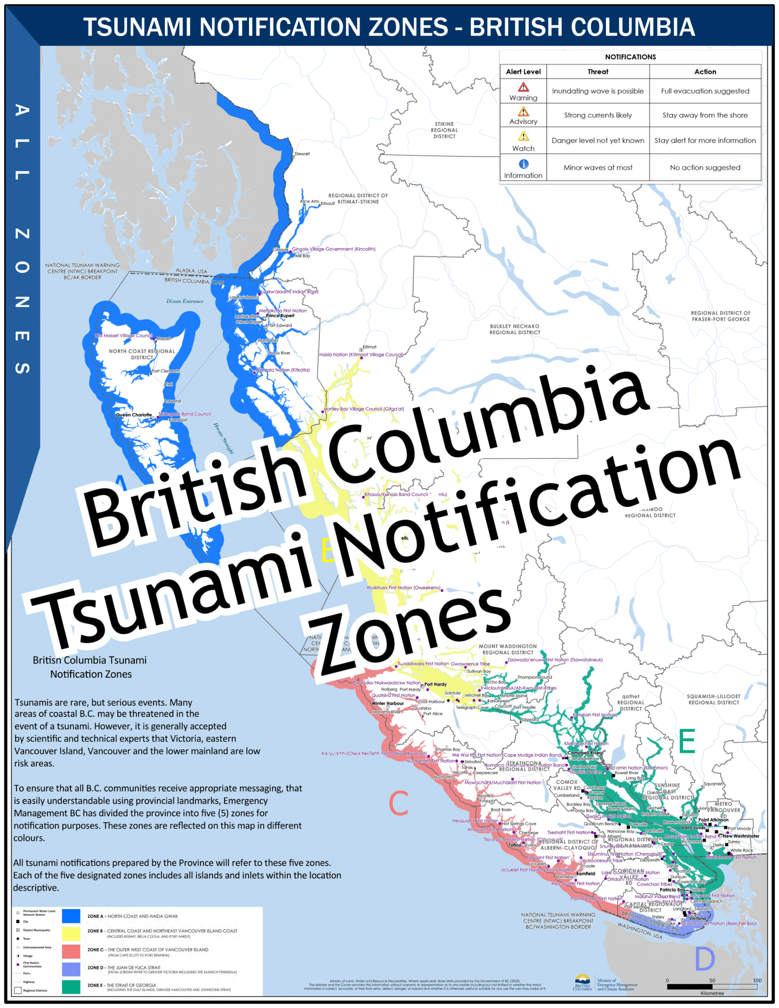
Tsunamis are rare but potentially devastating events. While many areas along coastal B.C. could be at risk in the event of a tsunami, scientific and technical experts generally agree that Victoria, eastern Vancouver Island, Vancouver, and the Lower Mainland face a low level of risk.
To provide clear and consistent information for all B.C. communities, Emergency Management BC has divided the coast into five notification zones, identified by different colours on the accompanying map. All provincial tsunami alerts will refer to these five zones, each of which includes all islands and inlets within its described area.
BLUE = North Coast & Haida Gwaii
YELLOW = Central Coast and Northeast Vancouver Island Coast
RED = Outer West Coast of Vancouver Island
PURPLE = Juan de Fuca Strait
GREEN = Strait of Georgia